-40%
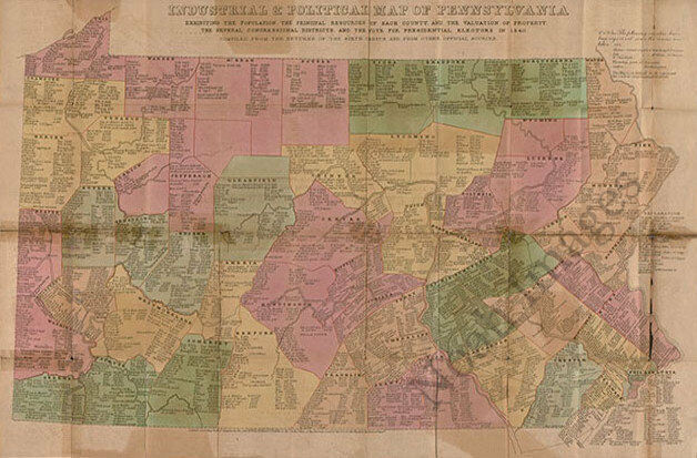
Industrial & political map of PA c1840 36x24
$ 5.25
- Description
- Size Guide
Description
Industrial & political map of PA c1840 repro 36x24Item Description
Industrial & political map of Pennsylvania : exhibiting the population, the principal resources of each county, and the valuation of property, the several congressional districts, and the vote for presidential electors in 1840. Printed to show extensive statistical data for each county.
Reproduction print.
Size :
36"
x
24"
½" inner white borders all around.
Please check out our Ebay store regularly for eclectic choices of fine reproduction maps and posters prints!
Thank you for looking, and Happy Bidding!


