-40%
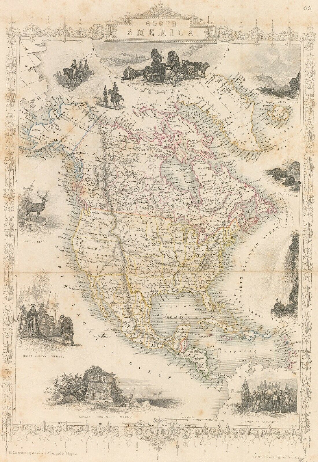
North America, 1855
$ 4.75
- Description
- Size Guide
Description
New World CartographicNorth America
By:
John Tallis
Date:
1855 (circa)
Dimensions:
14.5 x 10.25 inches (37 cm x 26 cm)
This is an authentic antique John Tallis map of North America, from his renown Illustrated Atlas of the World. Tallis' partner, and the engraver of the maps, J. Rapkin, is credited in the bottom right corner. The widely popular atlas was continuously published and circulated throughout the 1850's by the London Printing and Publishing Company.
This particular map outlines all the major topography, lakes and river systems as well as borderlines. Cities, towns and military forts are labeled, as well as coastal ports. The map is surrounded by a number of vignettes portraying landmarks, people and regional animal life.
Condition:
This map is in B condition.
Some light damp staining, and foxing around edges.


